Planning an Arkansas hiking trip? This trip itinerary shares the best hiking trails and campground stay in northwestern Arkansas.
What’s in this Guide
- How to Prepare for this Arkansas Hiking Trip
- Pedestal Rocks Loop Trail
- Kings Canyon Loop Trail
- Whitaker Point (Hawksbill Crag)
- Glory Hole Waterfall Trail
- Horseshoe Canyon Ranch
How to Prepare for this Arkansas Hiking Trip
Packing List
- Camping Essentials (click here to subscribe to my newsletter and receive a free packing list for camping)
- Day Pack
- Water Reservoir
- Ten Essentials (see this article here)
- Hiking Boots or Trail Runners (I recommend hiking boots for the rocky terrain, but consult this article here)
- Seasonally Appropriate Attire (always bring layers)
- Food (for on and off the trail)
About This Trip
I went on this trip with the Outdoor Adventures program at Grand Valley State University for spring break. The original plan included hiking in Alabama and Georgia, but this fell through due to weather. We ended up following the climbing group on their trip down to Arkansas and making up our itinerary as we went.
Although our Arkansas hiking trip was supposed to be five days with two days of travel, we ended up leaving the afternoon of the fourth day and driving through the night to avoid packing up camp in a snowstorm.
After a long day of travel on the first day, the second day of the trip we went to Pedestal Rocks and Kings Bluff Loop Trails and the third day we hiked Whitaker Point and Glory Hole Falls. For our fourth day we climbed in the morning at Horseshoe Canyon Ranch and headed out early afternoon for the drive back to Michigan.
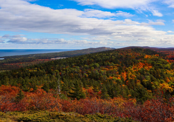
Since the original plan involved much warmer weather, we were very underprepared for the below freezing temperatures at night, but the daytime temperatures weren’t bad in early March. I recommend checking out this area in the late spring and summer when there are leaves on the trees or in the fall, which I think would be the ideal time for some fall color adventures.
Whenever you visit, be sure to pack for the weather and download or screenshot all trail and road maps. Service was spotty in the Ozark Mountains, so make sure you plan accordingly. And be ready for some real mountain roads with 10-mph curves and questionable guardrails. This is a definite sign that you’re in for a great adventure on this Arkansas hiking trip!
Pedestal Rocks Loop Trail
Trail Stats
- Distance: 2.5 miles
- Difficulty: Moderate
- Elevation Gain: 301 feet
- Format: Loop Trail
The Pedestal Rocks Loop Trail has amazing rock formations and mountain views to spare. Parking is at the Pedestal Rocks Scenic Area Trailhead in Ozark National Forest. This was the first trail that we hiked in Arkansas and the rocky terrain and steep inclines took us by surprise, but this is normal for most trails in this area. Many trails follow dried up creek beds, so practice caution when hiking after major rain.
Since this trailhead is for two different trails, check the map to make sure you’re headed the correct way. At the start of the trail, you’ll start off towards the left and when the trail splits off three ways, take either the left or straight route to the Pedestal Rocks Loop.
Be sure to keep an eye out for the side trails that go to different arch rock formations and caves. Small waterfalls are also common throughout the trail. Multiple signs warn of the cliffs and there are some very steep drop offs, so make sure to be careful and keep a close eye on any small children or pets on the trail with you.
Once you get back to the trailhead, grab a snack and rehydrate before tackling the Kings Bluff Loop Trail!
Check out the trail map on Alltrails here.
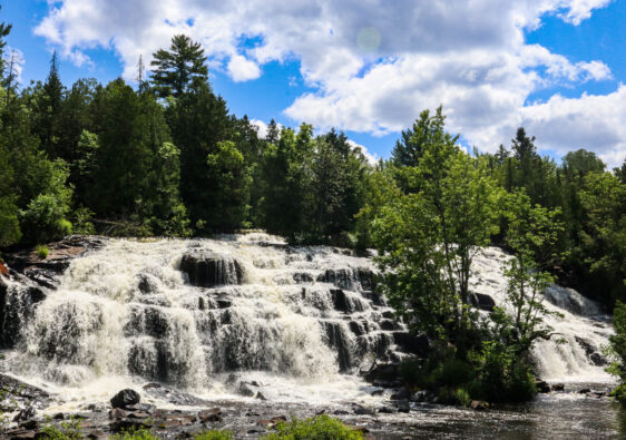
Kings Bluff Loop Trail
Trail Stats
- Distance: 1.9 miles
- Difficulty: Moderate
- Elevation Gain: 295
- Format: Loop Trail
If you’re short on time and can only do either the Pedestal Rocks or Kings Bluff Loop, I’d recommend Kings Bluff for the waterfall alone. Both trails start from the same parking area at Pedestal Rocks Scenic Area Trailhead. We opted to complete Pedestal Rocks and then do the Kings Bluff Loop on the same day to round out our first day of our Arkansas hiking trip.
Although the trails might become muddy and dangerous after significant rain, it’s also important to note that most waterfalls in this area are very small or nonexistent during dry seasons. Recent rain will make for best conditions when hiking the Kings Bluff Loop Trail.
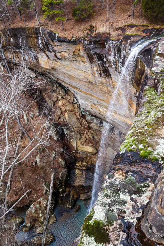
Kings Bluff Falls is one of the tallest waterfalls in the Ozarks at over 110 feet tall. You’ll also see several unnamed waterfalls along the trail after rain.
After passing Kings Bluff Falls and heading across an unnamed waterfall, there is supposed to be a side trail down to the bottom (possibly to the left) where several more waterfalls can be seen and you can see Kings Bluff Falls from the bottom. I personally didn’t try this, so consult Alltrails reviews and explore at your own risk. Remember to follow the principles of Leave No Trace and do not forge your own route off-trail if there is not a trail already present.
Steep cliffs and drop offs are also a safety issue on this trail, so be careful when exploring Kings Bluff Trail and don’t forget to stop and take in the views.
Check out the trail map on Alltrails here.
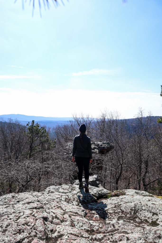
Whitaker Point (Hawksbill Crag)
Trail Stats
- Distance: 3 miles
- Difficulty: Moderate
- Elevation Gain: 413 feet
- Format: Out-and-Back Trail
Getting to Whitaker Point Trailhead
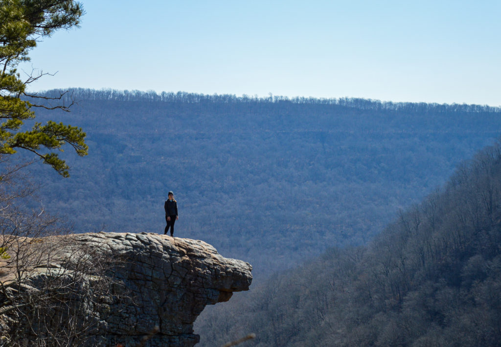
Whitaker Point, also known as Hawksbill Crag, is a very popular trail in the Ozark National Forest. We opted to start our second day of our Arkansas hiking trip with this iconic trail. While the trail is moderate, the biggest challenge of this hike is reaching the trailhead.
We took the route off AR021 S onto Co Rd S and came back the same way. There is another way up the mountain, but reviews indicated that the other direction has an even rougher road. It was over 6 miles of gravel road to the trailhead. The first section is the worst, with a very steep incline and drop offs that make you wish there were guardrails.
It’s doable without 4WD and I drove up it in a 15-passenger van (yes, it was terrifying). Watch out for traffic and consider using low gear when coming back down. I also wouldn’t attempt driving this after heavy rains.
Hiking to Whitaker Point
After reaching the trailhead, the out-and-back trail is easy to follow and includes a creek crossing. Make sure you take in all the scenic views leading up to Whitaker Point.
Summer or fall at sunrise is the best time to go. The views were amazing in the spring when we went as well, but with leaves on the trees, it would be even better. This trail gets busy, so it’s best to go early to avoid the crowds and secure a parking spot. If you don’t mind the bare trees, opting to go in the shoulder season in spring or late fall will also help with avoiding crowds. I wouldn’t advise driving to this trailhead in the winter.
This is a classic hike in the Ozark National Forest that you absolutely can’t miss, and don’t forget to get a shot from one of the open areas prior to Whitaker Point for your best social media post!
From Whitaker Point, we headed to Glory Hole Falls for our final hike of the day.
Check out the trail map on Alltrails here.
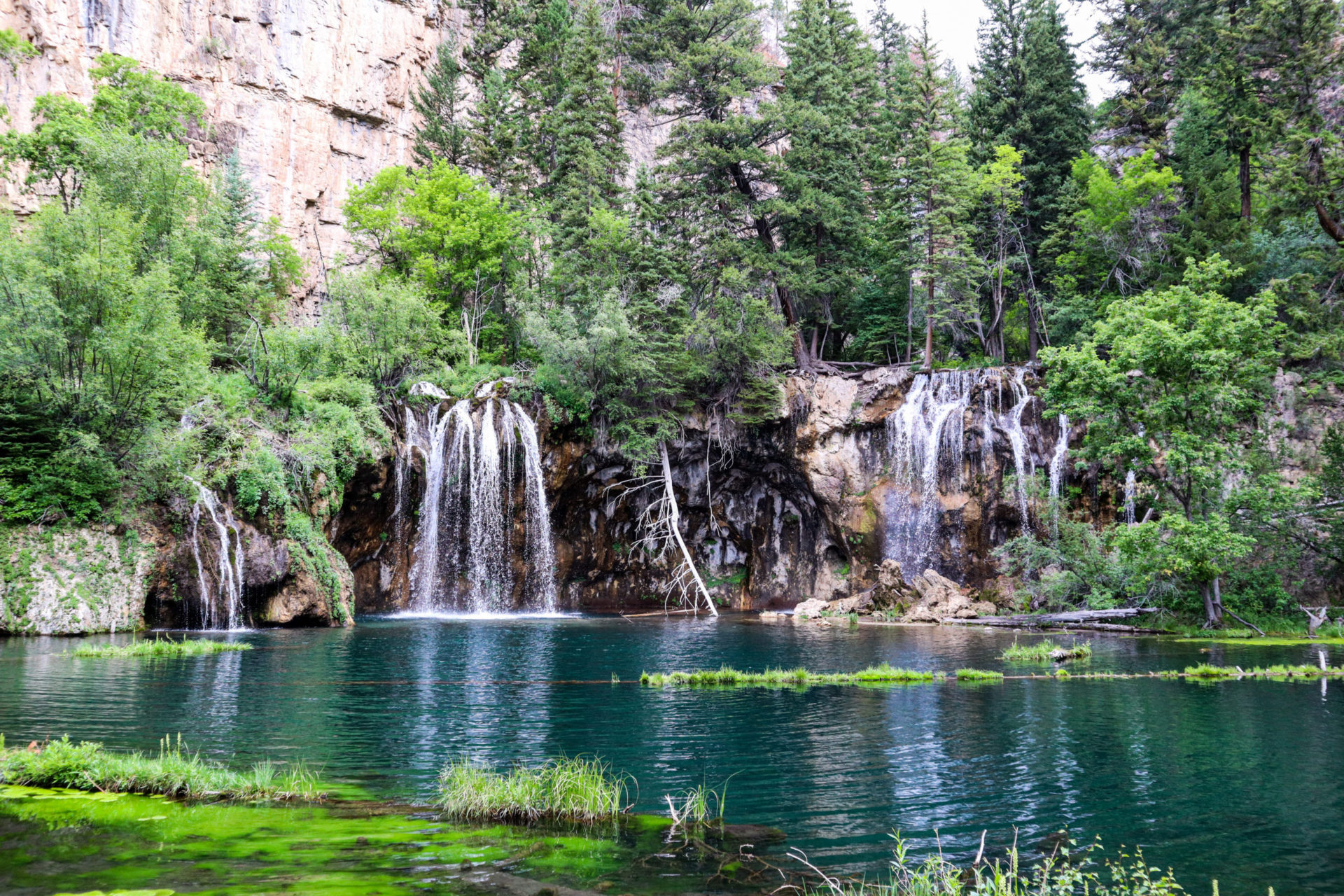
Glory Hole Waterfall Trail
Trail Stats
- Distance: 2 miles
- Difficulty: Moderate
- Elevation Gain: 410 feet
- Format: Out-and-Back Trail
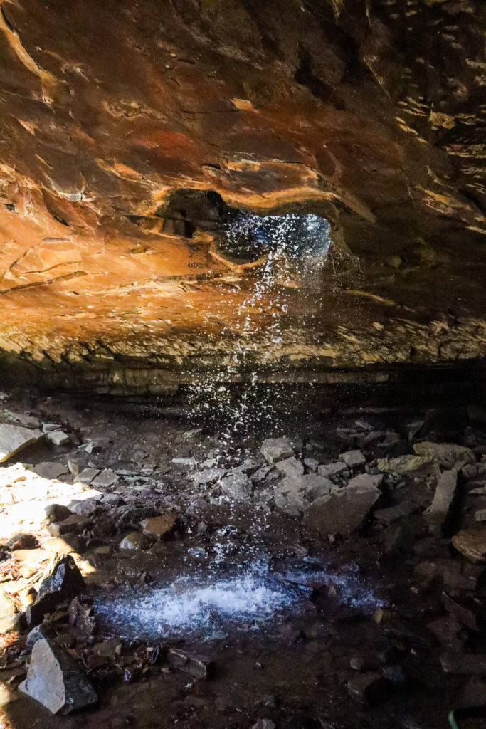
Like its name, Glory Hole Falls is a unique waterfall that you can’t miss while you’re in Ozark National Forest. Parking is just off AR-21 S on a corner, so make sure you get there early to secure a spot and be very careful backing out onto the road.
The rocky trail follows a creek bed, so it might be muddy after significant rain, but this will only make the waterfall that much better. After a steep downhill trail, you’ll come to the top of the falls first, where you can sit and take a break on the top of the cave.
Head off to the right and cross the stream twice to get to the cave. There you’ll see the water flowing down from above the cave.
Make sure to venture towards the back of the cave to see the handprints on the rock. If there’s been recent rainfall, there are also other waterfalls to explore near the cave. Glory Hole Falls may flow over the top of the cave as well.
And don’t forget to get a picture with the trail sign on your way out so you can show all your friends that you went to, well, Glory Hole Falls.
Check out the trail map on Alltrails here.
Horseshoe Canyon Ranch*
Lodging
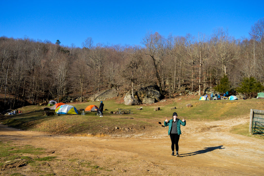
Since we ended up tagging along with the climbing group on this trip, we camped with them at Horseshoe Canyon Ranch Campground near Jasper, Arkansas. It’s located around 8 miles outside of Jasper, up into the mountains. The roads going up to the ranch are curvy and worth slowing down and taking your time for.
You can tent or car camp here for only $5.00 a night. Camping or day pass fees are waived for anyone under 12.
The road into the ranch is a bit rough, but 4WD is not necessary. Expect a rocky drive in and there is a section where you’ll drive through a creek if there’s been recent rain. I also drove a 15-passenger van in and out of this road, so just take it slow and you shouldn’t run into any problems.
There is a bathhouse building with flush toilets, access to hot showers, and water spigots with fresh drinking water outside. Shower tokens are $3.00 for only 5 minutes of hot water, so make sure you’re ready before turning on the water. When we got there, they were out of toilet paper in the bathrooms, but when the trading post is open the owners are more than happy to help with restocking supplies, just let them know.
And if you wait until the trading post opens in the morning (hours were 8-5 when we visited), you can get a fresh brewed cup of coffee before adventuring. Make sure you watch for all the goats while you’re here too! They wander wild around the ranch and might try to clean up your food if you’re not careful.
In case camping isn’t your thing, there are also cabins on-site and outside of the ranch available to rent. You can find out more about cabin accommodations here.
Activities
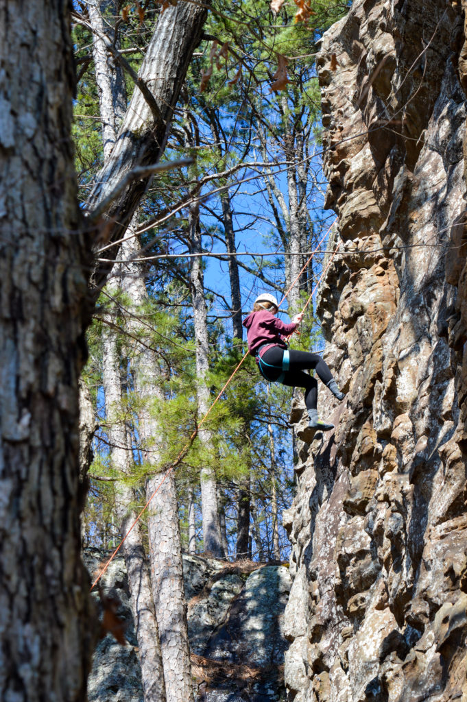
In order to hike around the trails on the ranch or climb with your own gear, you can purchase a day pass that comes with a wristband for $10.00 a day. We chose to get a day pass for one day and tried out top roping with the climbing group. It was a blast and I highly recommend trying it out once. In case don’t have your own equipment, there is a limited quantity available for rent at the the trading post. And if you haven’t climbed before but want to learn, there are guided climbing courses available on-site.
For more adventures at Horseshoe Canyon Ranch, there are countless activities to do like a zip line, climbing obstacle course, a quick jump, horseback riding, swimming, and canoeing. Horseshoe Canyon Ranch offers both day adventures and an authentic dude ranch experience.
All information on Horseshoe Canyon Adventures can be found here. For more details on the dude ranch facilities, visit this link here.
*=This is not a sponsored post associated with Horseshoe Canyon Ranch.
Liked this post? Pin it for later!